©www.bandion.it
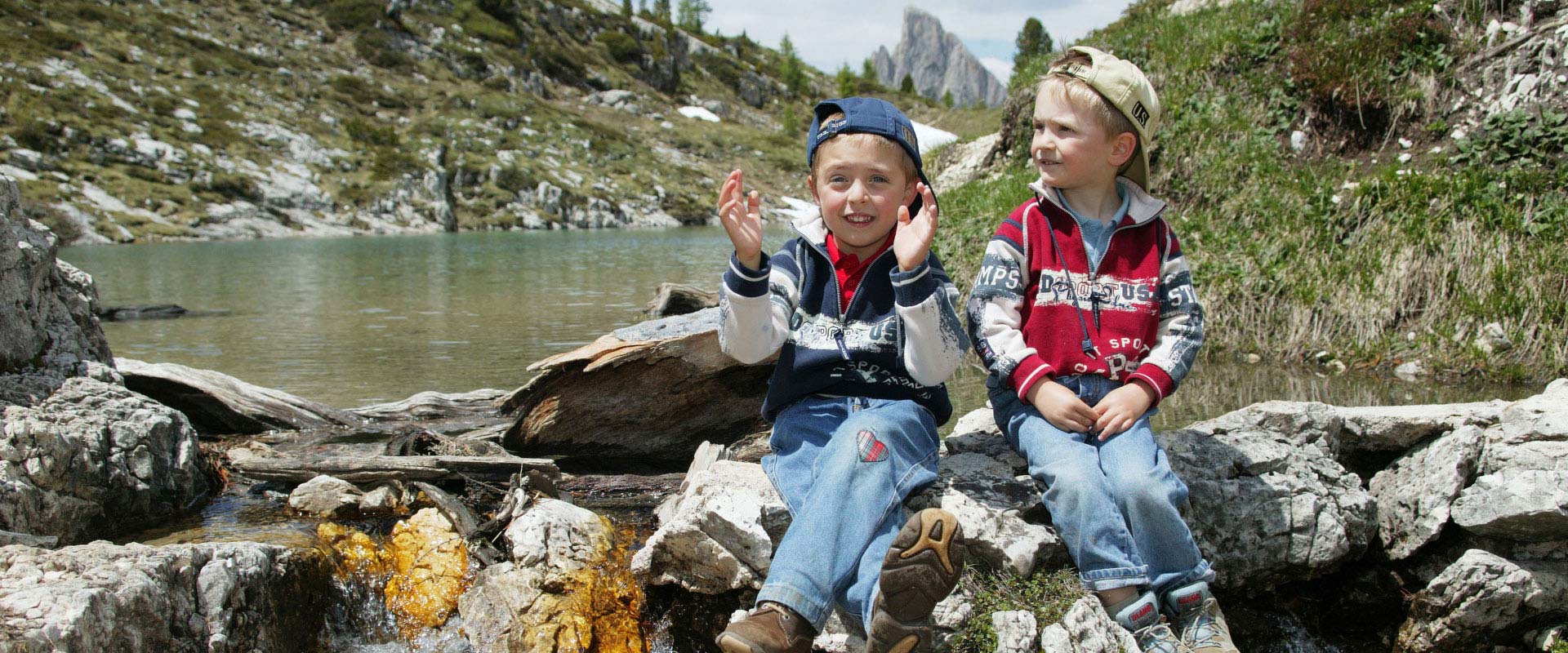
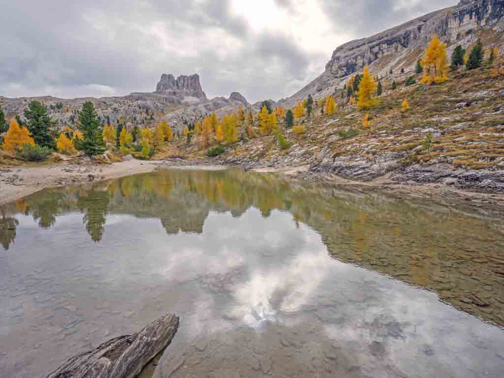
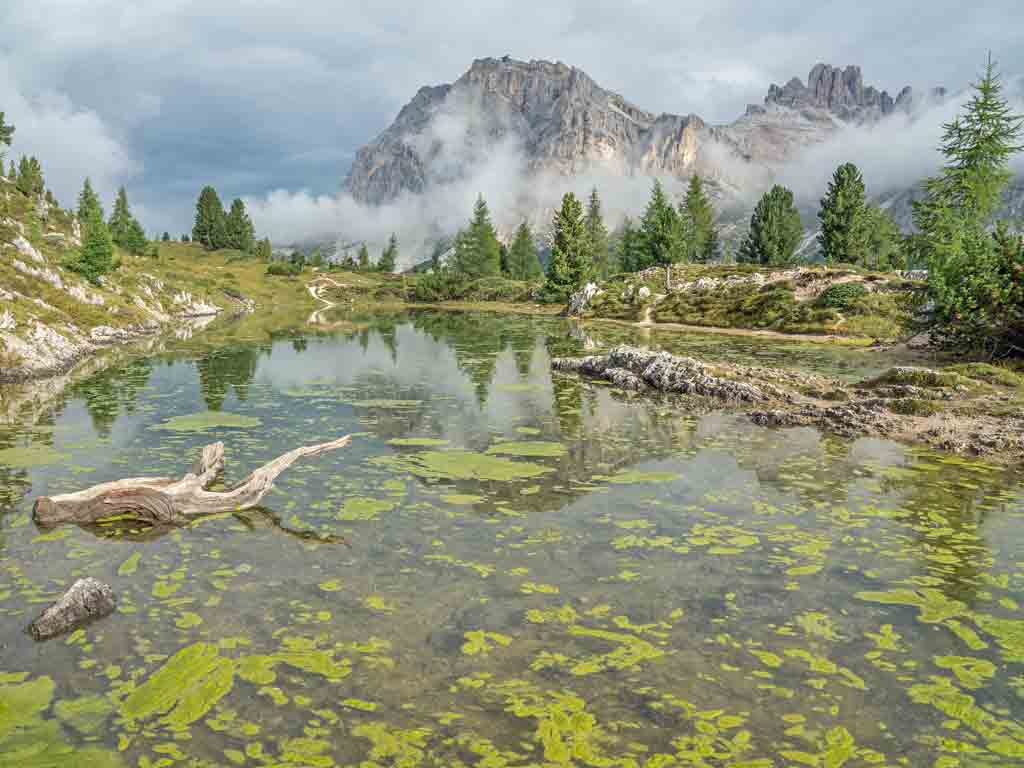
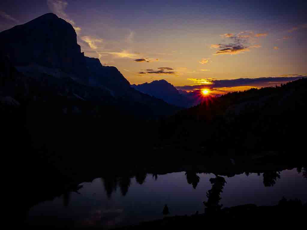
An easy hike for families to the limpid waters of the mountain lake Limides.
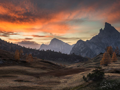
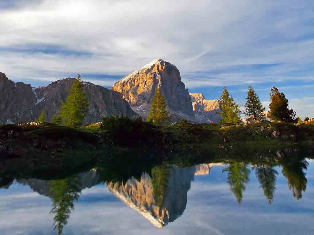
The undisputed beauty of this place attracts numerous photographers who capture stunning pics from dawn to dusk: as the hours of the day pass, the colours and atmospheres change but the iridescent magic of the place remains intact.
Lake Limides is a small high mountain lake set in an elongated basin, south-east of the Falzarego pass and north of Mt. Croda Negra, where the layers of dolomite stone are waterproofed by red clay.
This lake of glacial origins is fed by rainwater and melting snow. It has a small emissary that discharges only when the water level height reaches the overflow threshold.
In recent years the emissary drains only a few days a year and in late summer the lake dries up with increasing frequency.
That's why June is the best month for a hike to this high mountain lake.
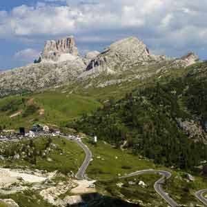
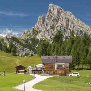
The walk starts near the Col Gallina refuge. Hiking the trail n° 419 towards the saddle Forcella Averau, uphill through a beautiful larch and stone pine forest, in less than an hour you reach the enchanting Lake Limides.
The majestic profiles of the mountains Averau, Sasso di Stria, Lagazuoi and Tofana di Rozes reflect in the clear water of the lake.
Departure point: Col Gallina Refuge
Arrival point: Col Gallina Refuge
Total duration: 2 ore/hrs./Std.
Path number: Cai 419
Total difference in altitude: 127 m.
Minimum altitude: 2.050 m.
Maximum altitude: 2.174 m.
Gear: mountain boots and high mountain clothing
Best time of year: the lake dries up at the end of summer thus June is the best time to visit it
GPX File: Download GPX

Consorzio Delicious Cortina
Via del Mercato, 14
I-32043 Cortina d'Ampezzo - BL
Telefono +39 0436 2863
C.F. e P.I. 01193820253
Consorzio Delicious Cortina
Via del Mercato, 14
I-32043 Cortina d'Ampezzo - BL
Telefono +39 0436 2863
C.F. e P.I. 01193820253
PRIVACY POLICY IN ACCORDANCE WITH ARTICLES 13, 14 OF THE GDPR (GENERAL DATA PROTECTION REGULATION) 2016/679
In compliance with the GDPR, your personal data will be processed according to the principles of fairness, lawfulness, transparency, and protection of your privacy and individual rights.
Holder and Controller of Personal Data Processing:
Holder of Personal Data Processing is Consorzio Delicious Cortina
located at 14, via del Mercato– 32043 Cortina d'Ampezzo
What data we collect
In order to use some type of services sometimes you may be asked to provide some personal data, i.e. first name and email address
Purposes of Personal Data Processing. Why we collect your data.
Direct Marketing activities: we utilize your email address to deliver information on our initiatives and cultural activities.
Legal Basis for the Processing of your Personal Data
Consorzio Delicious Cortina will require your consent before processing your personal data for direct marketing purposes.
Sharing and Disclosing Personal Information
On our website there are forms to contact some accommodation facilities in order to obtain information or book services. In this case you will be asked for the name and contact details that are necessary to manage your request and therefore will be transmitted to the owner of the accommodation.
Protection of personal data. Processing Methods
We have implemented adequate and suitable technical and organizational measures to safeguard and protect your personal data.
Such measures take into consideration the state-of-the-art of the IT system/environment, implementation costs, the nature of personal data, and the risks around processing personal data. The purpose is to protect your personal data against accidental or unlawful damage, destruction, or loss, unauthorized disclosure or access, and other forms of unlawful processing.
Besides the Holder, under some circumstances, third party entities may have access to your personal data, either internally when involved in the development of our website (administration, marketing, legal entities or service providers) or externally (third party providers of technical services, hosting provider). Whenever needed, the Holder will name these entities as Controllers.
Storage of Personal Data
Since your personal data is collected with your consent, it will be retained as long as you withdraw your consent to processing. You may withdraw your consent at any time. (See below the "Your Rights" chapter)
Your Rights
The GDPR provides the following rights for data subjects:
- The right to rectification: you may require the Controller to rectify any errors in your personal data.
- The right to restrict processing: you may require a restriction of personal data processing when you contest the accuracy of your personal data, or in case of unlawful processing, or if you object to the processing.
- The right of access: at any time and free of charge you may require the Controller to provide information on your personal data (concerning you), including information on the categories of personal data concerned, the purposes of our processing, and the possible recipients we may have disclosed your personal data.
- The right to data portability: you may require the controller to transmit your personal data to another controller, if this is technically feasible and provided that the processing of your personal data is based on your consent or is necessary for the performance of a contract.
- The right to erasure: you may require the controller to delete your data when:
a) personal data is no longer necessary for the purpose for which it was originally collected or processed;
b) you withdraw consent to processing;
c) you object to processing and there is no overriding legitimate grounds for continuing the processing;
d) the data have been processed unlawfully
The right to erasure will not apply if the processing is necessary to comply with a legal obligation or for the establishment, exercise or defence of legal claims.
- The right to object: at any time you may object to the processing of your personal data for direct marketing purposes. In this case your personal data will no longer be processed for these purposes. Should you decide to exercise this right, please let us know whether you mean/want to delete your personal data or restrict their processing.
You may exercises these rights or obtain further information by emailing: info@cortinadelicious.it
Use of cookies and log files
This website makes use of cookies. Below you will find further information on cookies, how they are used in this website and the control procedures we use with regard to the cookies.
If you continue browsing this website you are consenting to the use of cookies, in accordance with the terms of this policy. The type of cookies used in this website does not require previous consent by the users.
About cookies
Cookies are small files of data that a website asks your browser to store on your computer or mobile device. Cookies may then be sent back to the server each time the browser requests a page from the server or may be sent to a different website able to recognize that specific cookie. The cookie allows the website to "remember" your device every time you return to that website.
Types of cookies in this website
A session cookie is used for a single session and will expire at the end of the browser session, when the web browser is closed. These technical cookies do not require the user's consent prior to their use.
This website also uses third party technical cookies like the ones provide by Google Analytics and You Tube.
Google Analytics is an Analysis Tool provided by Google which utilises performance cookies to collect anonymous navigation data (IP truncated at the last octet) and aggregate information to measure how users interact with the website content, to create reports on users' activities in the website and provide further information, such as the number of visitors and the pages they have visited.
Google may also transmit this information to third parties when required by legal obligations or when third parties process this data on behalf of Google. Google will not associate your Ip address to any other data in their possession. Personal data provided to Google are stored on Google servers in the US.
In compliance with the specific agreement with Google, designated as controller of personal data processing, Google is committed to process this data in compliance with the Holder's requirements (see below) given by the software settings. Based on the settings, advertising and sharing options are disabled.
For further information on Google Analytics Cookie Usage visit: Google Analytics Cookie Usage on Websites.
Users may selectively disable data collection from Google Analytics by installing the opting out tool provided by Google on their browsers.
YouTube is a platform for video sharing owned by Google that uses cookies to collect information about users' activities and navigation devices. Videos on this website do not carry cookies to access the page because the "no cookie policy" has been set, according to which YouTube does not record users' personal data unless they voluntarily choose to play the videos.
For further information on personal data usage and processing by Google, we recommend reading the information on the dedicated page prepared by Google and the page on How Google uses information from websites or apps that use their services.
How to control and delete cookies
Most web browsers support cookies, but users can change the settings of their browser to decline them, delete the existing ones or simply be informed when a new cookie is sent to their device.
To set their browsers to decline cookies, users can refer to the directions given by the browser provider (usually in the menu “Help”, “Tools” or “Modify”). The following link contains a more detailed guide about cookies: www.aboutcookies.org